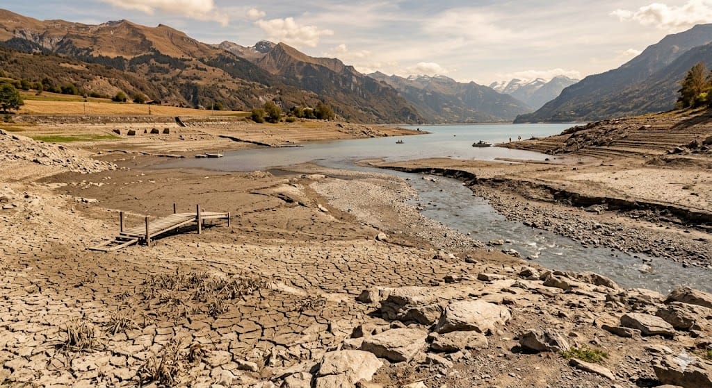


Switzerland Faces Early Heatwave Over 30°C.
Switzerland has experienced its first short heatwave of the year during the Whitsun weekend, with daytime temperatures rising above 30°C across several regions.
However, according to the Federal Office of Meteorology and Climatology MeteoSwiss, the event does not officially qualify as a heatwave. In Switzerland, a heatwave is only declared when the average daily temperature reaches 25°C or more for at least three consecutive days.
Meteorologists emphasize that the key factor is the 24-hour average temperature, which includes cooler nighttime and morning hours. Although daytime temperatures exceeded 30°C at multiple stations, the overall daily averages remained below the official threshold.
At the Basel-Binningen station, temperatures reached 31°C, but the average daily temperature was recorded at 22.9°C. Similarly, in Sion, temperatures peaked at 32.4°C, while the average remained around 23°C.
Despite this, both locations officially recorded “hot days,” as temperatures crossed the 30°C mark during peak hours. However, this alone is not sufficient to classify the event as a full heatwave.
Experts highlight that nighttime cooling plays a crucial role in reducing health risks. When nights remain cooler, the human body and cardiovascular system are able to recover, reducing stress caused by prolonged heat exposure.
MeteoSwiss also noted that such early-season heat is unusual but not unprecedented. Historical records show that the earliest hot days in Switzerland were recorded in May 1945 in Basel and May 1958 in Sion.
On average, Switzerland’s first hot day typically occurs in June, around June 7 in Sion and June 9 in Basel-Binningen, indicating that this year’s warm spell arrived earlier than usual but remains within natural variability.